Security concerns lead satellite image suppliers to limit public access
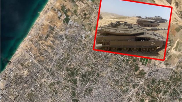
Satellite image suppliers have begun to restrict access to images of Gaza, as reported by the Semafor portal. These innovative technologies turned out to pose a significant issue by enabling enemy forces to continually monitor the current locations of the Israeli forces through high-quality satellite images.

"Planet Labs, in conjunction with several other competitors, has radically transformed disaster reporting by offering the general public access to high-resolution photographs that were once only accessible to government intelligence agencies," observed the Semafor portal, indicating the primary benefit of publicly accessible satellite images.
These images enable the tracking of virtually any transformations around the globe, owing to the high quality of the materials. However, these tools also come with a downside. The constant public release of these photographs reveals many state secrets, including military ones.
Mainly due to concerns over revealing current troop positions, leading satellite image suppliers have chosen to regulate the disclosure of these materials. Companies like Planet Maxar Technologies have been transmitting images with a minimum two-day delay since the start of November, according to reports from Semafor. Airbus took a comparable decision, abstaining from publishing any images from Gaza.
It's essential to understand that the use of satellite images is not a recent development limited to the Middle-Eastern conflict situation. Ukrainians also apply this technology to analyze enemy troop movements, frequently highlighting the placement of early warning radars and S-300/400 systems in Crimea by the Russian Federation's forces.
In Ukraine, satellite images have frequently been employed to decipher actions taken by the Russian air forces. A case in point are the materials from October of this year, which revealed that the enemy had secretly positioned several aircraft at one of the airfields. Satellite images prove to be an invaluable aid in scenarios where traditional surveillance methods, such as radars, are challenging to implement.


